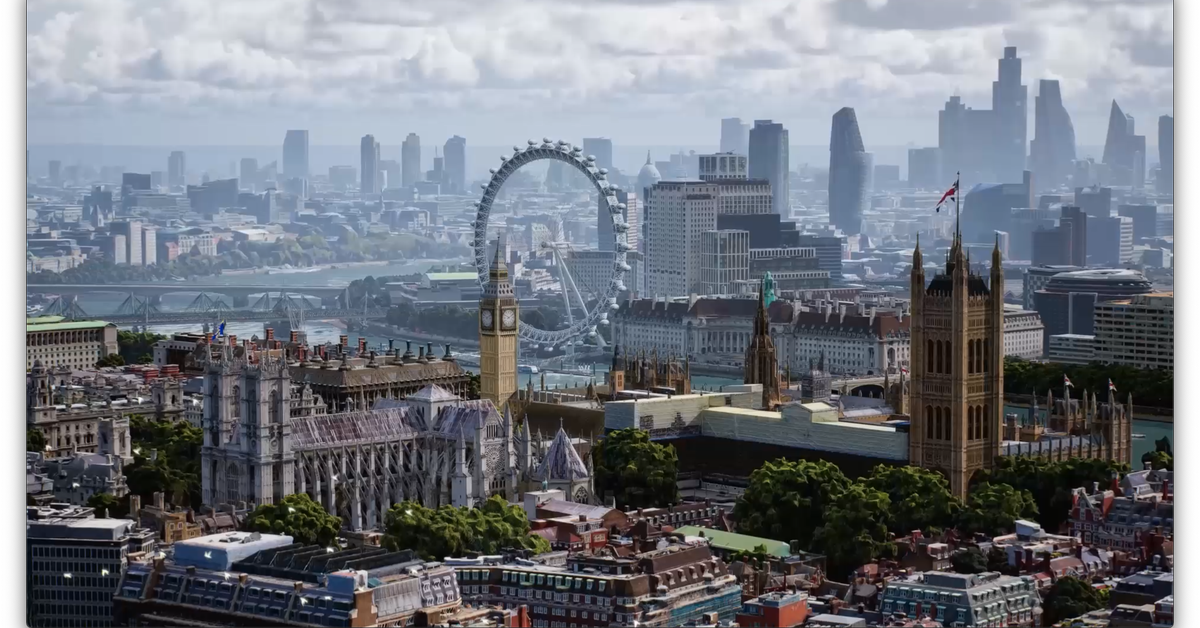
Google launched a new mode for Maps on Wednesday, designed to give users a more real-life look at the places they’re going before they even go. The new Immersive View is sort of a Street View in the sky: you can look over a location from above to get a sense of the neighborhood and then drop to street level to see the specific spots you might want to hit up. Maps overlays its live busyness and traffic info, so you get a quasi-augmented reality look at whatever park or street corner or beach spot you’re looking at.
The images behind Immersive View are all computer-generated, a combination of Google’s satellite captures and its Street View shots. As you move through them, it looks like playing a video game on medium graphics set in a precisely scaled real world. “We’re able to fuse those together,” says Liz Reid, a VP of engineering at Google, “so that we can actually understand, okay, these are the heights of the buildings. How do we combine that with Street View? How do we combine it with aerial view to make something that feels much more like you were there?”
Reid described the feature as offering the magic of Google Earth’s massive zoom but on a neighborhood level. And she said Google’s been working on it for a while. “It’s a thing where we had demos years ago and it was like, ‘oh, here’s the thing,’ but it didn’t really work. Now the technology has come a long way into making it feel pretty natural.”
Immersive View works on most devices, Reid said, but so far only works in a few neighborhoods in San Francisco, New York, Los Angeles, London, and Tokyo. More are coming soon.
:format(webp):no_upscale()/cdn.vox-cdn.com/uploads/chorus_asset/file/23453277/Maps_Immersive_View_screenshot.png)
As it pushes on making Maps a more live, 3D experience, it’s also opening some of that experience up to the app ecosystem. Third-party developers can now tap into the Live View AR feature of Maps, which essentially gives them super precise location tracking in the real world and an AR layer on top. Google’s working with developers on apps that help you find a place to park your scooter, or help you navigate stadiums, or just let you play AR games with dragons in the real world.
Google Maps is really no longer just an app for getting from place to place. It’s increasingly turning into a digitalized version of the real world, which could have huge implications as AR gets bigger and as Google shifts its focus from crawling the web to crawling the Earth. And, with Immersive View in particular, it’s starting to be obvious how much Google can do with all the data it has.